
Tracing a Carson Street by Address
A useful Carson street directory result is built in layers. The Los Angeles County Assessor supplies the physical parcel and its assessor parcel number, or APN. Carson GIS shows the shape and neighbors. The Registrar-Recorder/County Clerk, commonly called RR/CC, holds the deed chain, but its real-estate index is organized by party name and year rather than street address. A voter product may help only through a permitted election purpose. Reverse directories add a historical listed-occupant layer.
Start with the address you can state exactly. Keep the street number, direction, suffix, unit, and ZIP spelling in a research note. Then move from the current parcel to earlier documents, rather than treating one search result as proof of every person at that location.
- Run the complete situs address through the Los Angeles County Assessor Portal and save the APN, legal description, parcel details, and map view.
- Open the Carson parcel layer and click the target polygon, adjoining parcels, parcels across the street, and any shared condominium or mobile-estate parcels.
- Use the APN and current owner evidence to identify a party name, then search the RR/CC index by indexed party and recording year.
- Review Carson permit and planning files by address, using the Civic Access portal or the responsible city division when the older file is not online.
- For earlier households, turn to LAPL reverse directories, the LA County Library Californiana shelf, and released census material.
The order matters. It keeps an address search tied to a real parcel while leaving room for records that describe ownership, listed occupants, or civic activity rather than residence.
Carson Street Addresses Start with an APN
The county assessor search is the practical bridge between a Carson street and a legal parcel. Its public controls support an address or assessor identification number search, plus a legal search mode and an interactive map. Normalize the street suffix and direction if the autocomplete misses a result. An APN is the assessor key for the parcel, not a household number and not a deed document number.
Parcel detail can include the situs address, municipality, legal or use description, tax-rate area, land and improvement values, effective year built, building characteristics, and a map link. The county web result may suppress a broad owner-name search. Carson's official municipal parcel service can expose owner and mailing fields, which creates a real county-city asymmetry. Treat that display as an owner or mailing lead, not as proof of present occupancy.
The mailing address deserves its own note. It may be a trust, business, service address, PO box, or an old extract. A different mailing address can suggest an absentee owner, but it does not identify the people inside a Carson parcel.
| Assessor mode | What to enter |
|---|---|
| Address | Street number and name, with direction and suffix normalized when needed. |
| Assessor ID Number | Ten-digit APN format: four-digit map book, three-digit page, three-digit parcel. |
| Legal Search | A separate mode for legal-description-oriented searching. |
| Map Search | Zoom, pan, and select parcels to see geometry and nearby polygons. |
Exact control labels can change, so capture the live screen before relying on a field. The property roll answers where the parcel is and what the county associates with it. It does not turn the Carson address guide into a complete list of households.
Reading Carson Street Parcels Side by Side
The Carson parcel feature service adds the map layer that an address-only result lacks. The parcel layer can carry APN, situs and mailing components, tract, zoning, recording date, use and document codes, exemption values, prior and last sale fields, building traits, legal description, and parcel area. The service supports spatial queries, pagination, and responses of up to 2,000 features.
For a street-by-street pass, start from the Address Points layer when available. Click the target parcel at a useful scale. Record the APN and then inspect every polygon that touches it, the parcels opposite it, and the same street face within the boundary chosen for the research question. A block is not always a clean rectangle, and a condo or mobile-estate parcel may not map one polygon to one household.
The map also carries context layers such as city boundaries, council districts, specific-plan areas, zoning, schools, streets, ZIP maps, and methane or landfill buffers. Those layers explain why two nearby addresses can sit under different civic or postal labels. They do not add private utility, delivery, DMV, or unlisted household data.
The service's owner and mailing attributes are useful leads when visible, but GIS extracts can lag the county roll. Do not copy a sample person's name into a published directory. Preserve the field names and parcel identifiers, then verify a material ownership claim with the county or the recorded instrument.
The Carson GIS endpoint is the best source for understanding a parcel's neighbors because it exposes geometry and attribute structure together.
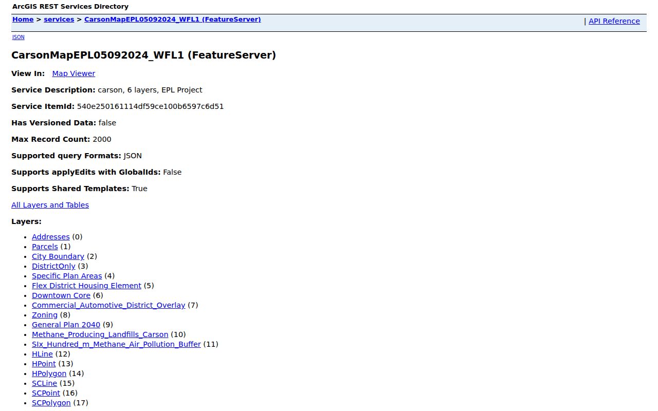
The parcel view gives a Carson address search a stable map anchor, while the surrounding records still need separate verification.
Carson Address Records at a Glance
Several systems can be walked by address, but they answer different questions. Use the table as a handoff map. An address record set is strongest when one identifier, such as an APN or document number, carries the search from one keeper to the next.
| Record set | Keeper | Street-level value | Access route |
|---|---|---|---|
| Assessor parcel | Los Angeles County Assessor | APN, situs, values, characteristics, mailing lead | Free address, APN, or map search |
| Carson GIS | City of Carson | Parcel geometry, adjoining polygons, ZIP and zoning layers | Free map and feature service |
| Recorded documents | LA County RR/CC | Transfers, liens, legal descriptions, indexed parties | Name/year index, then paid copy request |
| Permits and plans | Carson Building, Planning, Engineering | Work, applicants, contractors, inspections, dates | Civic Access, counter, phone, or CPRA scope |
| Reverse directories | LAPL and library/archive collections | Listed occupants, businesses, phone or street order | Free digital viewer or research collection |
| Voter file products | LA County Registrar-Recorder | Authorized registration, street or election data | Purpose declaration, fee, and restrictions |
Ownership belongs to the deed and assessor trail. A listed name belongs to the directory's publication date. A voter record is restricted election information. A permit shows a transaction with the city. The differences keep the Carson address chain accurate.
Carson Street Deeds Follow Parties
The LA County RR/CC viewing page states the key limitation: real-property records run from 1851 to the present, yet the county does not provide a public online index by address or APN. The historical index is used in person by party name and year. At Norwalk, 1851-1957 material is reviewed on the lower level and 1958-present material on the second floor.
Once the assessor or Carson GIS supplies a current owner lead, search the party as a grantee in the year of acquisition. A grantor is the party conveying an interest. A grantee receives it. Read the current instrument for the earlier seller, then search that seller as a grantee in an earlier year. Confirm the legal description, APN, recording date, and document number at each turn.
The county accepts plain or certified copy requests online, by mail, fax, or in person after a record is identified. A plain copy is $5 for the first page and $3 for each additional page. A certified copy is $6 for the first page and $3 for each additional page. LexisNexis can process an already identified document, but it is not a public address index. Staff do not conduct a full index search by phone.
A county records office can explain procedure and custody. It will not create a resident compilation from a street name. That is why the Carson address workflow begins with the assessor and ends with a named instrument.
The official RR/CC copy-request page shows the handoff from a located index entry to a usable deed copy.
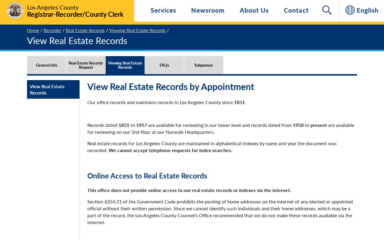
The viewing instructions make the offline index a documented Carson access rule, not a missing web feature.
The same RR/CC request channel explains how an identified instrument moves to a plain or certified copy.
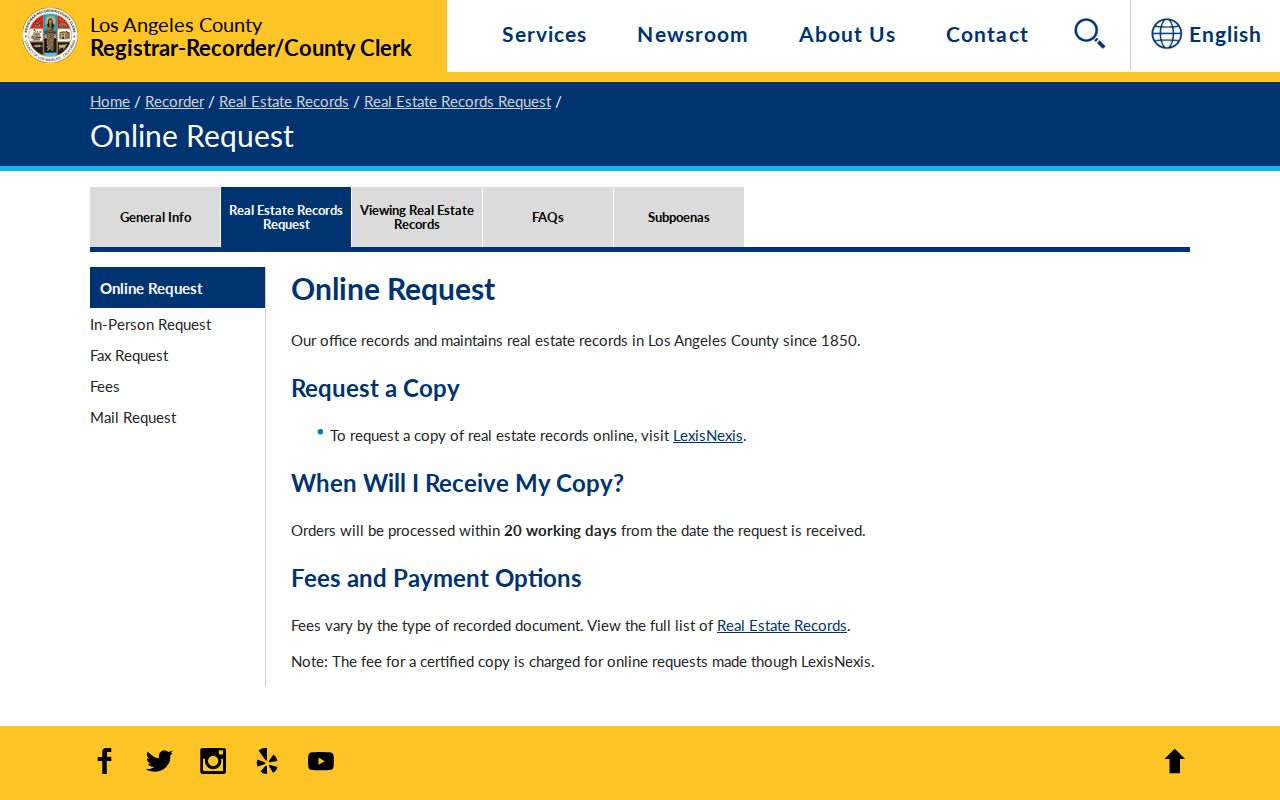
A copy request completes the address chain only after the party, year, and document have been identified.
Carson Street Permits Put Dates on Addresses
Carson Civic Access launched June 4, 2024 for Planning, Building and Safety, and Engineering. It supports applications, permits, plans, materials, payments, and inspections from a single online entry point. An address search may expose a permit number, applicant, owner, contractor, scope, value, dates, or inspection status when the public record and portal view include those fields.
The portal is not a complete historical resident index. Pre-June 2024 files may need Building and Safety staff or a narrowly written request to the City Clerk. The Building and Safety counter is at City Hall, 701 E. Carson St.; the published phone is 310-952-1766, with counter hours Monday through Thursday, 7 to 6. Planning uses 310-952-1761, and the Clerk uses 310-952-1720.
A permit records a project or inspection. It can date a change to a parcel and name people who filed or performed work. It does not prove that an applicant lived at the address. For a defined older file, send the Carson City Clerk a request with the street address, permit or case number if known, date span, responsible division, and desired format. The Clerk locates identifiable existing records rather than researching or creating a new compilation.
The Carson Civic Access information page describes the portal's role and its department contacts.
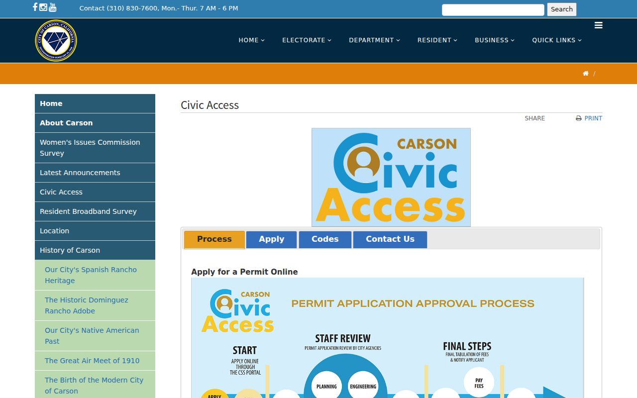
The permit portal adds a dated civic layer to the Carson address guide, while older gaps call for the named city custodian.
Carson Street ZIP Labels Cross Lines
Carson's municipal boundary and postal geography do not match. The municipal parcel layer contains substantial 90745, 90746, 90810, and 90248 counts, plus the institutional 90747 area. A 90810 address can sit in Carson while using Long Beach postal geography. A 90248 address can sit near the northwest industrial edge while using Gardena postal geography.
Use the USPS city and state lookup to verify whether a mailing address is deliverable and which ZIP it uses. Use Carson's City Boundary or GIS layer to decide whether the parcel lies inside the city. Census ZCTAs that touch Carson include 90220, 90221, 90248, 90744, 90745, 90746, 90747, and 90810, but a ZCTA is an approximation, not a legal boundary.
That distinction matters in a Carson address guide. A postal city line can send a searcher toward Gardena, Long Beach, Wilmington, or Compton records even when the parcel is governed by Carson. Preserve both the situs city and mailing label before requesting a deed or permit.
USPS supplies postal verification, not an owner list. The Assessor and city GIS supply parcel context. None of those layers should be treated as a full household roster.
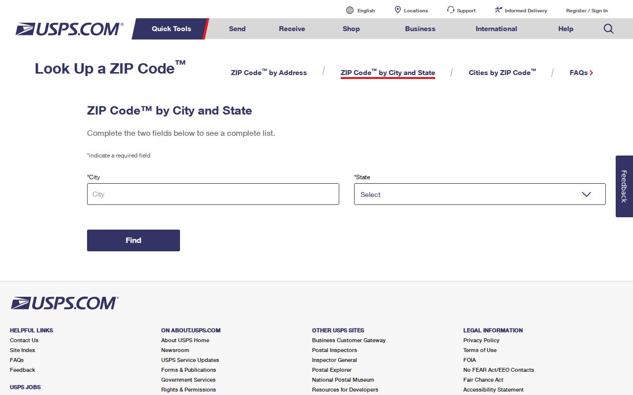
The USPS result is one check in a Carson address search, not a substitute for the city boundary layer.
Carson Street Directory Reverse Volumes
Reverse or criss-cross directories sort by street and house number rather than surname. LAPL's Los Angeles-area collection includes reverse volumes from 1906, 1927, and 1956-1987 within a broader 1875-1987 directory run. The South Suburban criss-cross holdings cover 1972-1995, while South Central and South Coast titles offer promising 1990-1992 coverage. Exact Carson inclusion varies by volume, so inspect the title and its geographic notes.
A reverse entry can show a listed occupant, business, or telephone detail for the publication year. It does not show every person present, and a missing line proves only that the name was not listed. Street abbreviations and filing order vary. Numbered streets and avenues may fall before, after, or among named streets. The volume's own arrangement is part of the search.
Use the free LAPL digitized collection or ResCarta browser first. For a difficult Carson variant, ask the LA County Library Norwalk Californiana staff for a place and year search. A full historical shelf is also available through CSUDH materials, but finding aids describe boxes and series rather than promising digitized resident pages.
Older volume conventions and family-history tracing belong in the Carson city directory collections; the address guide uses them here only as a past-occupant cross-check.
Carson Street Directory Terms
Street research gets muddled when a parcel label, mailing label, and legal instrument are treated as the same thing. These terms keep the Carson records chain precise.
- Parcel
- A mapped piece of land or an assessed unit. One polygon may cover a complex, not one household.
- Situs address
- The physical location of the parcel. It differs from the address used for tax notices.
- Plat
- A recorded map that describes lots, blocks, streets, and subdivision geometry.
- Criss-cross directory
- A reverse directory arranged by street and number, often listing an occupant, business, or telephone entry.
- Index versus image
- An index points to a record. The recorded image or certified copy is the instrument itself.
Keep the original spelling and the source date. A street name can be shortened, a parcel can split, and an owner mailing address can change without changing the physical situs.
Limits of a Carson Street Directory
Public address records describe parcels and filed events. They do not supply a complete list of occupants, private utility customers, delivery accounts, minors, or people whose addresses receive special protection. DMV personal information is restricted by the federal Driver's Privacy Protection Act. Voter street products are restricted election records, not a general neighbor directory.
Use Carson street records for personal, lawful research such as tracing a deed, understanding a block, reconnecting with a known person, or checking a suspicious property solicitation. Verify an important result with the custodian. Do not turn a parcel map or listed name into a way to watch, threaten, or harass anyone.
Lawful use. Address records are partial public evidence. Harassing, stalking, or intimidating a person with Carson records can violate California law and the rules of the record keeper.
A protected-address participant may disappear from a public trail by design. A non-match may also reflect a spelling difference, a parcel split, an old extract, or a record set that was never indexed online. The right response is a narrower request to the actual custodian, not a guess about the person behind the address.